Terrestrial 3D Laser Scanning

AUAV are more than drone operators. As data specialists we offer a range of complementary services that facilitate the capture of 3D digital twins.

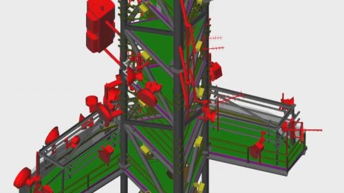
Using the latest laser scanning technology we have the capability to capture detailed 3D point clouds of infrastructure, processing plants and buildings. The data is presented as either stand-alone point clouds or can be integrated into the workflow with our photogrammetry tools.

The resultant outputs are typically used to facilitate the design of new structures or can be integrated into our inSite online 3D software. The terrestrial laser scan data is particularly useful when representations of structures with little textural differentiation are required.

For more information on Terrestrial Laser Scanning, contact us.

Benefit From Experienced Terrestrial Laser Scanning

Terrestrial laser scanning.
Typical applications include:
  • Rail infrastructure.
  • Interior visualisations.
  • As built plans of plant.
  • High accuracy measurements.

Get in touch with us today

This field is for validation purposes and should be left unchanged.