Drone LiDAR Survey & Mapping

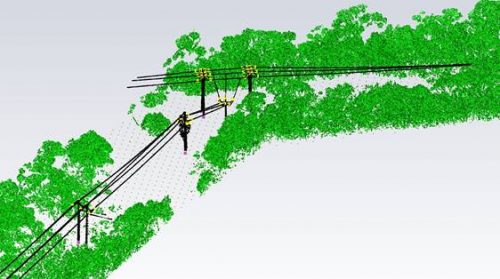
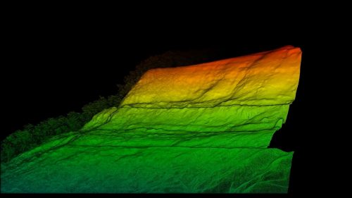
LiDAR (Light, Detection and Ranging) refers to a method of survey data capture whereby a laser is reflected off an object and the response time to the return sensor enables the calculation of the distance. When many thousands of laser pulses occur every second a detailed 3D point cloud of the surroundings can be created.

AUAV have prepared a detailed comparison of the difference between drone aerial LiDAR surveys and those captured using photogrammetric methods. Data capture with a drone-based LiDAR is more expensive than that completed with photogrammetry, mostly due to the costs of the sensors and drones that are required to carry them.

There are many sensors on the market at different price points and this can dramatically affect the accuracy of the final data.

Where LiDAR comes into its own is where there is dense vegetation as the laser pulse will be more able to reach the ground compared to the photogrammetry derived survey model.

For more information on asset inspection in your specific area of interest, see our list of industries we service, or contact us to discuss your needs.

Typical Cost-Effective Uses of LiDAR Includes

  • Survey of land under dense vegetation.
  • Assisting in the 3D modelling of complex or shiny structures.
  • Identifying vegetation encroachment into powerline corridors.
  • Catenary analysis of conductors.
  • Covering large areas where the data is needed quickly after capture.

Get in touch with us today

This field is for validation purposes and should be left unchanged.